I’ve alluded to how I try to avoid public transportation here in Rome and I’m hoping my new bike will make getting around this circus a little easier…as soon I have the courage to pedal away on these crazy streets. I took it for a little spin around Monti yesterday, but it’s the larger roads that terrify me. I had dinner with a friend last night who commented that her new bike has simplified getting around the Eternal City and I can’t wait to muster up the nerve and follow suit.
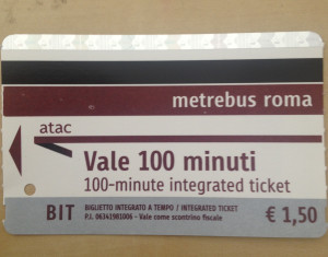
Yea, so I’m not fond of public transportation here. Firstly, the directions you get from the ATAC website are incredibly inefficient and here’s why. It’s great that they tell you which bus/tram/metro to take, the direction it’s going in and the name of the stop where you should exit, but to get to and from the modes of public transport on foot, all it says is something like, “Walk 800 meters to (insert street name or transportion stop).” Doesn’t direct you right, left, north, south, east, west or on to which streets you might be turning. So for me, checking ATAC is always coupled with copious note taking during a thorough Google Maps street analysis prior to my departure, plus an on-the-spot iPhone map consultation once I de-board. I just learned that Google Directions now gives detailed instructions that include specific public transportation routes–this wasn’t always the case–so that kind of makes things a bit easier, but there’s something else….
The directions (both Google and ATAC) instruct you to take the tram or bus, say “nine stops,” then give you the name of the stop for which you should exit. The caveat: the buses and trams don’t make every stop unless its requested by a passenger or someone waiting to board signals the driver to stop; so unless you can score a seat or standing location by the right window to feasibly count all the stops during your journey, you can’t rely solely on keeping track of how many times the bus/tram stops. One way to easily amend this would be to have the bus/tram announce or display the forthcoming stop so you can rest assured that you won’t miss it when you’re suffocated on a crowded vehicle with no window in sight. But this doesn’t appear to be in the cards. I can’t be the first and only person irritated by this so I’m sure there’s some illogical bureaucratic rhyme and reason behind it.
What I have been doing in these situations is plugging the address of my final destination into my iPhone map and watching the route as the bus or tram slowly approaches. This has proven an effective way to help gauge where and when I should get off, but this is a lot easier said than done when you’re standing on a crowded bus/tram smothered by no concept of personal space, struggling to keep your balance. Obviously, if you’re on a repeat trip, finding your way becomes a little easier the second time around, but the uneasiness that accompanies that first time can give one enough anxiety for a lifetime. Here’s to hoping ATAC adopts a marginally more efficient way! Otherwise, I’m going to need to keep a Xanax prescription on hand for these first-time public transportation adventures.


Die ATAC, hell is actually run by ATAC roma